

Looking for the best things to do in Arizona? From walking the rim of the Grand Canyon and slipping through the glowing walls of Antelope Canyon to hiking among giant saguaros, red rock trails in Sedona and some of the darkest night skies in the US, this is what you shouldn’t miss.
Arizona is a state of big landscapes and even bigger skies. Red rocks and cacti give way to vast canyons, volcanic craters and Wild West towns, and one moment you’re peering down at the Colorado River from the edge of the Grand Canyon, the next you’re driving between the sandstone buttes of Monument Valley.
I’ve explored Arizona on two very different road trips. The first, in early summer, took me to the South Rim of the Grand Canyon, where I walked the Rim Trail and flew over the canyon in a helicopter, then on to Page for Upper Antelope Canyon, sunset at Horseshoe Bend and a day trip out to Monument Valley. The second, in February, started in Tucson and Saguaro National Park, then took me north to Montezuma Castle, Sedona (in the snow!) and Phoenix.
This guide to the best things to do in Arizona starts with the places I loved most on those trips, then covers everything else worth your time, from ancient cliff dwellings and fossilised forests to ghost towns, caves and a meteor crater.
The best things to do in Arizona
Walk the Rim Trail at the Grand Canyon
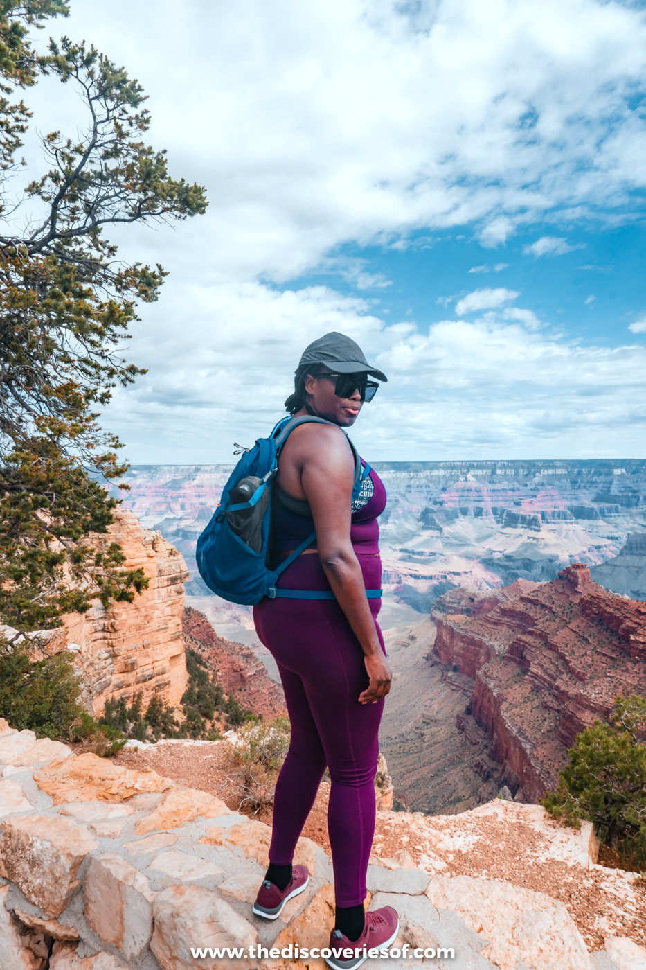
No matter how many pictures you’ve seen, nothing prepares you for the scale of the Grand Canyon: layer upon layer of rock dropping away into the abyss and winding off to the horizon as far as you can see. It’s the best-known sight in Arizona for a reason.
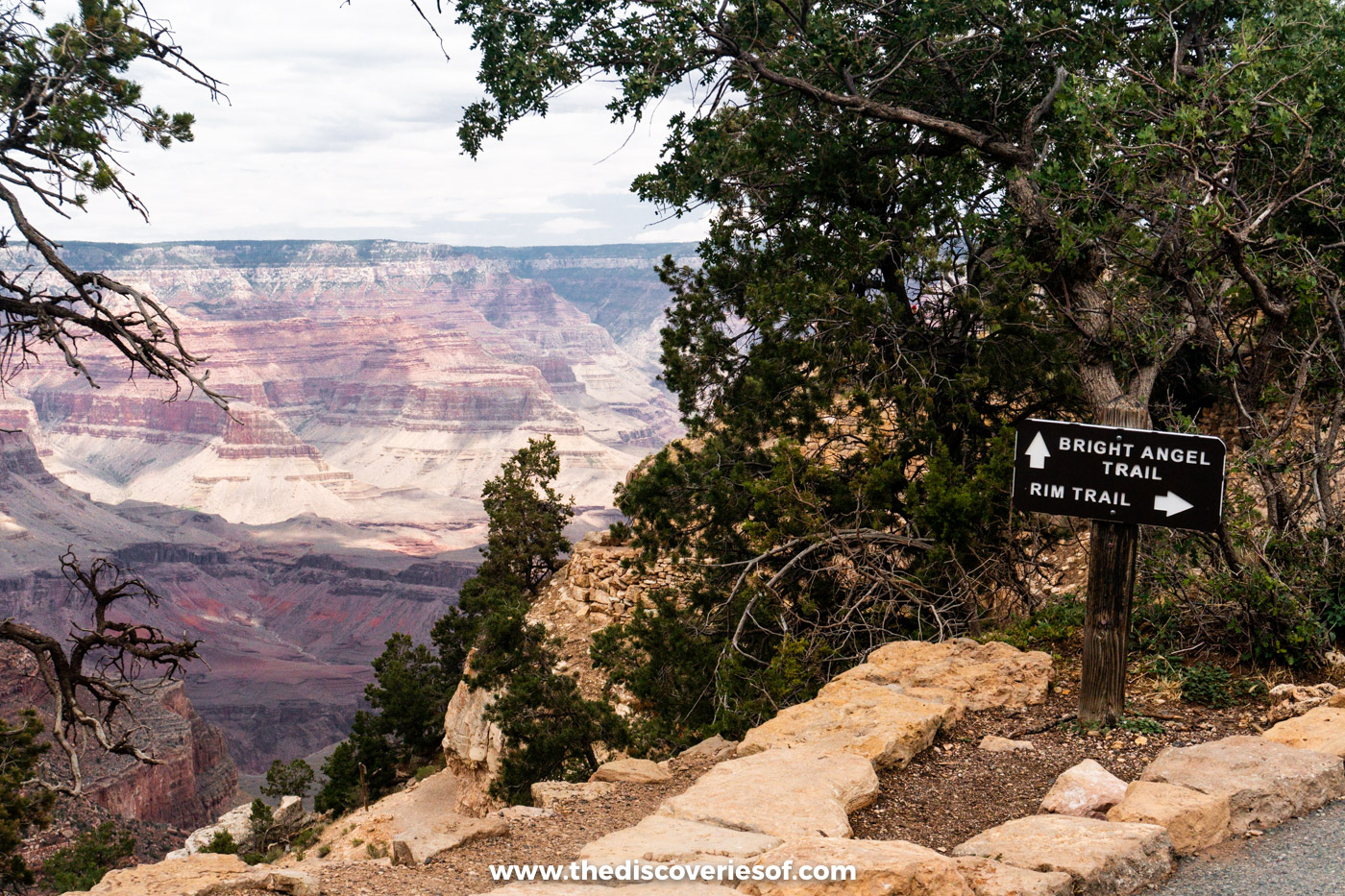
If you only do one thing here, make it the Rim Trail. It’s by far my favourite walk in the park. I’ll admit I pooh-poohed the idea at first because it sounded too easy, but I’m so glad I did it: the views change at every bend, and you get a real sense of the canyon’s size. The trail runs for about 13 miles along the South Rim, from the South Kaibab Trailhead to Hermits Rest, and it’s mostly paved and fairly level, so you can walk as much or as little of it as you like and hop on the free shuttle buses to get back.
The section between Powell Point and Monument Creek Vista is a dirt path that runs close to the edge, and it’s one of the most dramatic stretches of the whole trail. Finish at Mather Point, where I watched my first Grand Canyon sunset, as the sky turned orange and the canyon walls glowed.
Before you go: after a flash flood damaged the pipeline that supplies the South Rim with water at the end of August 2026, overnight stays inside the park have been suspended, with the first lodges due to reopen in phases from 20 November 2026. The rim itself stays open all year, and hotels in Tusayan, just outside the South Entrance, are unaffected. On the North Rim, the historic Grand Canyon Lodge was destroyed by the Dragon Bravo Fire in 2025, and only some areas have reopened for 2026. Check the National Park Service’s alerts before you travel.
Top Tip
Pack a lunch, as the chances of lunchtime coinciding with somewhere selling food are slim. Bring salty snacks and a big water bottle too. The rim is around 7,000 ft up, and I felt the altitude more than I expected.
Fly over the Grand Canyon in a helicopter
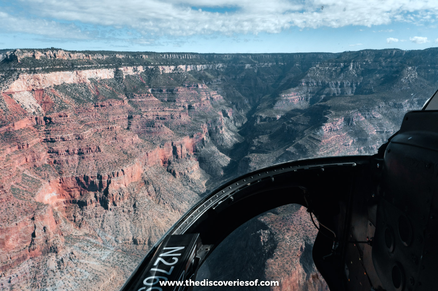
Don’t just hop out of the car and snap a few shots: if you want to see the canyon from a completely different angle, take to the skies. I flew with Papillon on their North Canyon helicopter tour from Grand Canyon Airport in Tusayan, and I’d highly recommend it.
The flight takes off over the ponderosa pines of the Kaibab National Forest before the ground suddenly falls away beneath you. As you fly over the rim, the landscape transforms from scrubland to a miasma of colours and shapes, and you get a great view towards the North Rim, the lesser-visited side of the canyon. The 30-minute flight is a good choice if you’re not sure how you’ll feel about flying, and there are longer routes if you want more time in the air.
Top Tip
Pay the extra (it was $50 when I flew) for the front seat next to the pilot, and bring photo ID. It can be bumpy on windy days. Read my full Grand Canyon helicopter tour review before you book.
Walk through the glowing walls of Upper Antelope Canyon
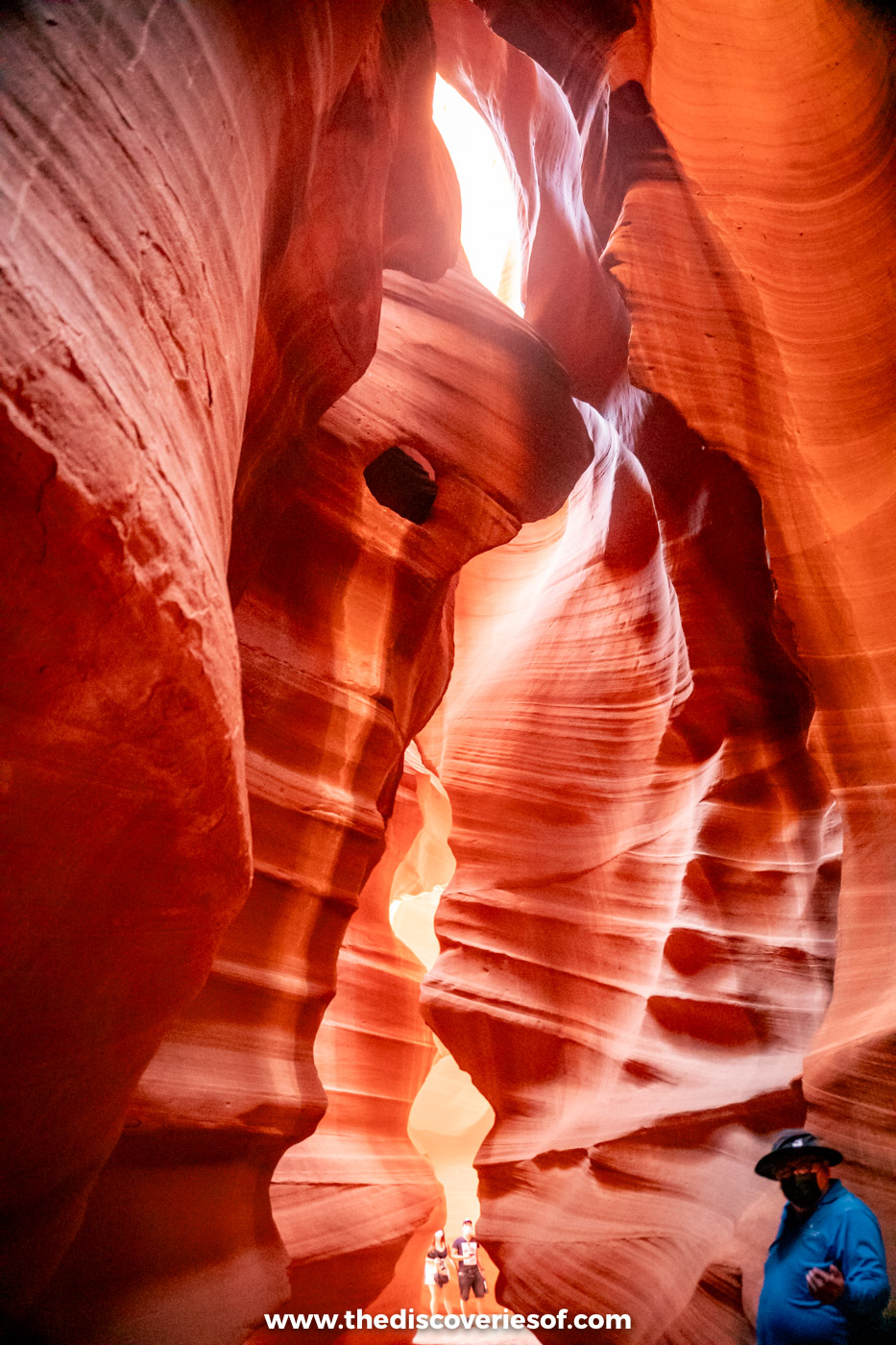
You’ve probably seen its golden swirls all over social media, but nothing beats seeing Antelope Canyon up close. This series of slot canyons sits on Navajo land just east of Page, where flash floods have carved the sandstone into narrow, curving corridors that glow orange and purple as the light filters down from above.
The canyon is split into two sections, Upper and Lower Antelope Canyon, each with its own operators, and you can only visit on a tour with a Navajo guide. You can visit both, but they’re separate tours. I did this Upper Antelope Canyon walking tour, which was great. Upper Antelope is the easier walk, along the flat floor of the canyon, while Lower Antelope involves ladders and stairs, and this Lower Antelope Canyon tour takes about an hour in the canyon itself.
Top Tip
The famous light beams appear in Upper Antelope Canyon from roughly late March to early October, around the middle of the day. Midday slots cost more and sell out first in summer, so book well ahead.
Watch the sun set over Horseshoe Bend
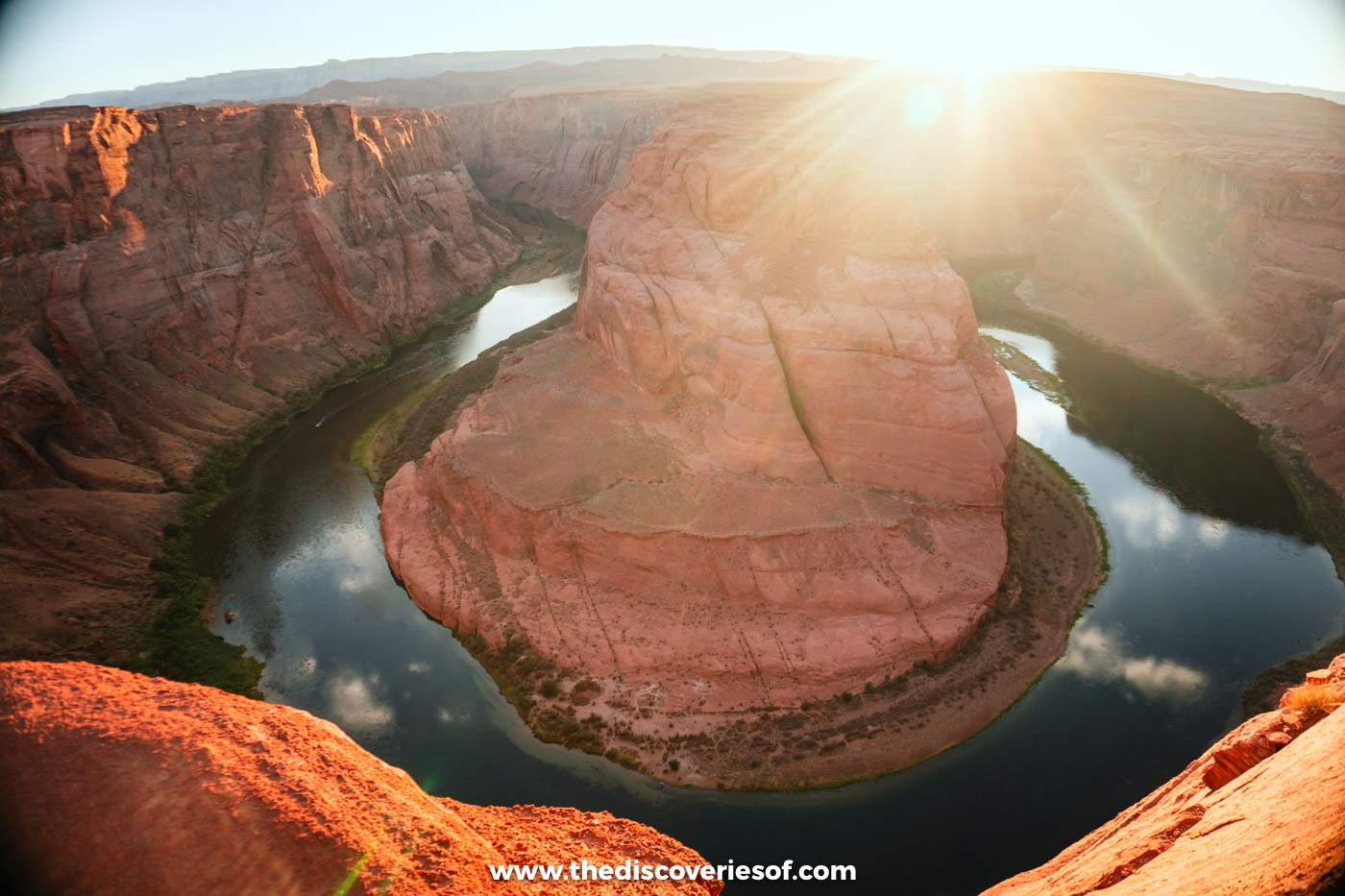
It’s not often that I use words like spectacular or breathtaking, but there’s no denying that Horseshoe Bend is both. About 5 miles south of Page, the Colorado River loops around a great dome of sandstone some 1,000 feet below the rim, carving the distinctive horseshoe shape that gives it its name.
The walk out to the overlook is about 1.5 miles round trip on a clear, wide path, and I found it really easy, taking 20 to 30 minutes each way. I went for sunset, when the canyon walls glow and the heat of the day has eased off, but be prepared to share the view: the platform was packed when I visited. Parking costs $10 per car, and national park passes aren’t accepted.
Do
If you’re based in Las Vegas, this full-day Grand Canyon, Antelope Canyon and Horseshoe Bend tour covers all three in one long day.
Road-trip out to Monument Valley
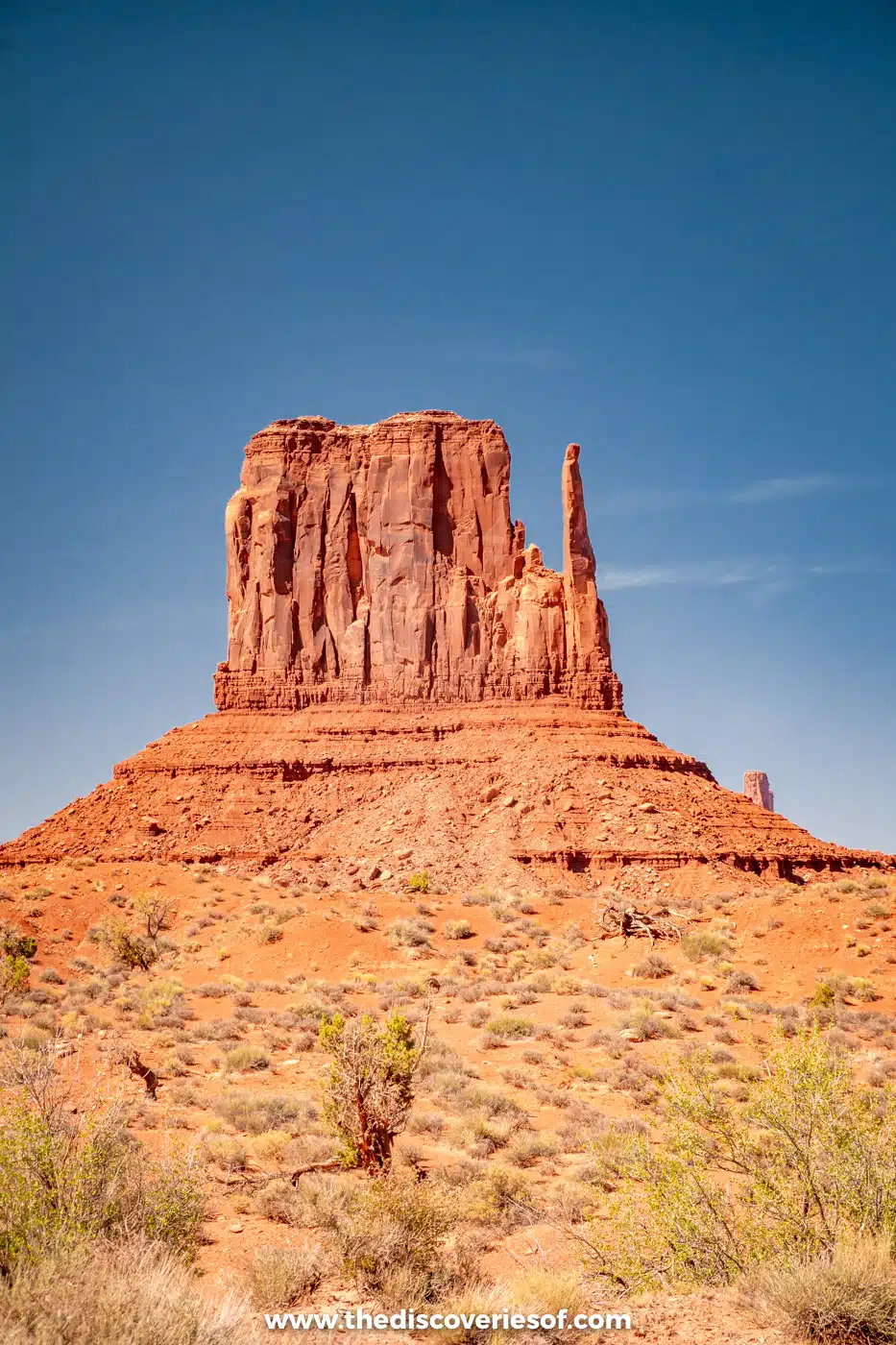
Ready to drive through one of Arizona’s most iconic landscapes? Of course you are. Straddling the border with Utah on the Navajo Nation, Monument Valley is a land of towering sandstone buttes and mesas, some rising 1,000 feet above the valley floor, that look like they’ve been lifted straight out of a western (because many of them have).
I visited on a day trip from Page. It’s a longish drive, around two hours each way, but it’s worth it, and I stopped at Forrest Gump Point on US-163 on the way in for that classic shot of the road running straight towards the buttes.
Monument Valley Navajo Tribal Park is run by the Navajo Nation, and you can drive the 17-mile Valley Drive yourself: it’s unpaved and sandy in places, and closed to RVs and motorbikes. Entry costs $10 per person, plus $15 per vehicle for the drive, and US national park passes aren’t valid here. To reach the backcountry areas that are off-limits to independent visitors, you’ll need to join a tour with a Navajo guide, and there are a handful of trails you can walk on your own.
Top Tip
The Valley Drive closes well before sunset (last entry is 2:30pm from October to January and 4:30pm from May to September). For the full show, join a Monument Valley sunset tour with a Navajo guide, or plan your visit with my Monument Valley travel guide.
Hike among the red rocks of Sedona
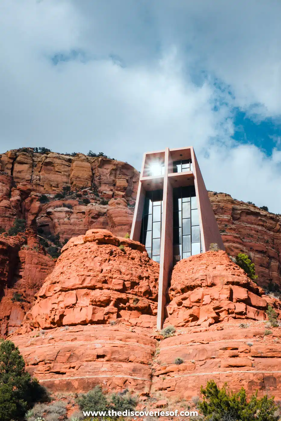
So many Americans I spoke to named Sedona as their favourite place that I had to go and see what all the fuss was about. The reality is fascinating: spirituality meets spectacular landscapes, with some very commercial bits thrown in for good measure. The town itself is a strip of crystal shops, psychics and jeep tour kiosks, but the towering red rocks around it are the real draw, so escape the town as often as you can and get out on a trail or two.
I visited in February and even saw the red rocks under a dusting of snow. The Courthouse Butte Loop was pretty much my favourite hike in Sedona: it takes you all the way around Courthouse Butte and Bell Rock, with expansive views of the red rocks the whole way. For sunset, head up to Airport Mesa, which has some of the best views in town. There’s a small free pull-out on Airport Road, but you’ll pay to park at the lookout at the top.
Don’t miss the Chapel of the Holy Cross, a striking modern chapel completed in 1956 that seems to rise straight out of the buttes south of town. You can go inside, but it’s the exterior that really wows. Beyond that, Sedona has a thriving arts scene, from the galleries of Tlaquepaque to the Exposures International Gallery of Fine Art, and there are dozens more hikes to choose from, including the short scramble to the Birthing Cave and the easy stroll through Fay Canyon.
Do
For the red rocks without the effort of a strenuous hike, a guided vortex jeep tour takes you out to the landscape on rough backroads in about two and a half hours.
Step back in time at Montezuma Castle
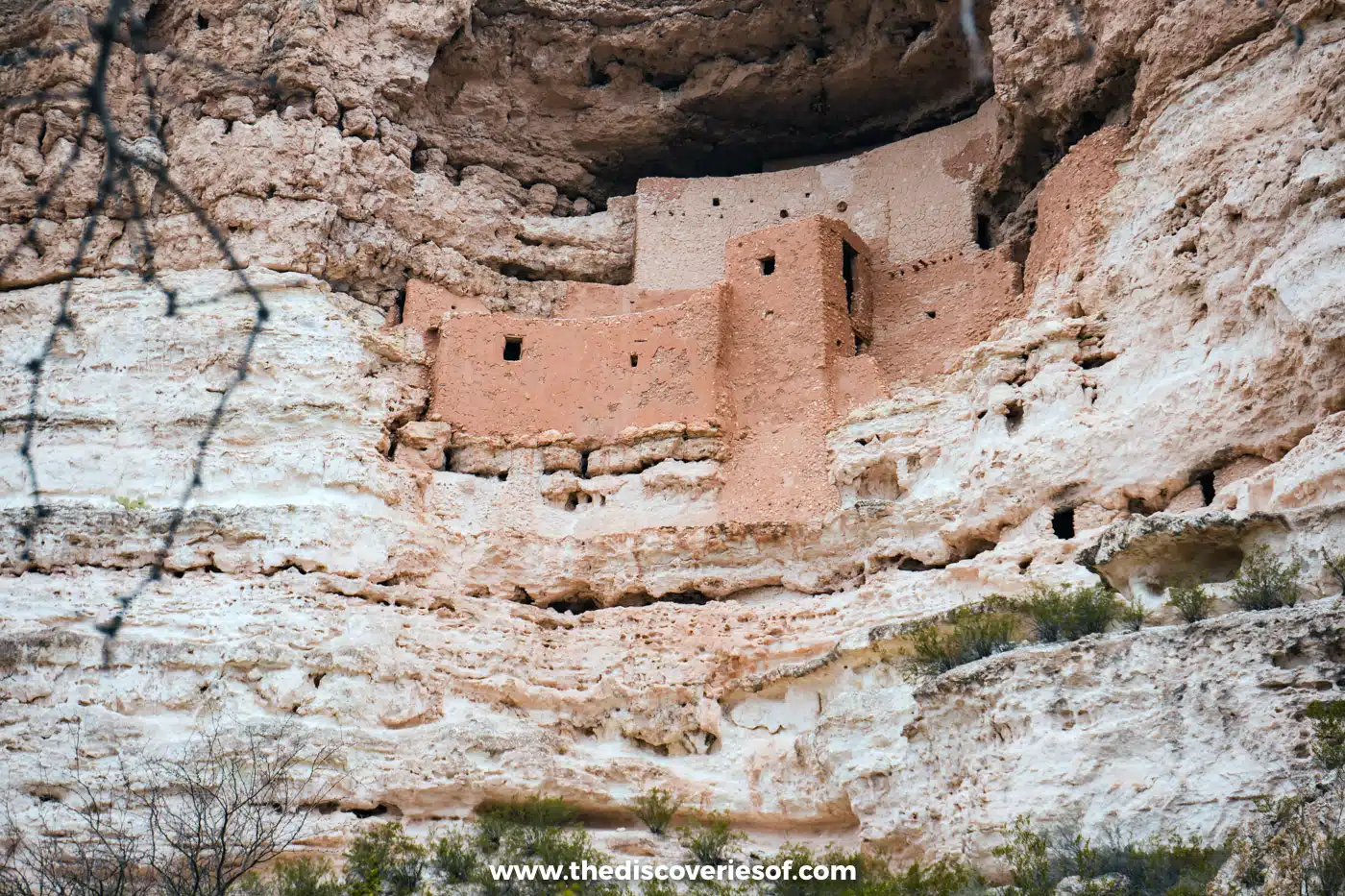
If you want to engage with the history of the Southwest, a visit to Montezuma Castle National Monument is essential. I visited in February, and these striking, well-preserved dwellings set into the side of a cliff are well worth a visit while you’re in the area.
Built by the Sinagua people in the 1100s and 1200s, the five-storey, 20-room “castle” sits in a limestone alcove about 90 feet up a sheer cliff above Beaver Creek. Despite its name, it has nothing to do with the Aztec emperor Montezuma: early settlers wrongly assumed the Aztecs had built it. You can’t go inside (access ended in 1951 to protect it), but a short, paved, third-of-a-mile loop trail leads beneath it.
The monument is in Camp Verde, just off I-17 at exit 289, about 40 minutes from Sedona and an hour and a half from Phoenix, so it’s an easy stop between the two. Entry costs $10 per adult and also covers Tuzigoot National Monument nearby, and Montezuma Well, about 11 miles away by road, is free.
Slow down in Phoenix

Don’t let the state capital be just a quick stop on your way to Arizona’s natural wonders. Phoenix is a big city with a chilled-out vibe, and the best way to enjoy it is at your leisure. I spent a few days here in February, and my highlights were the Heard Museum, one of the most respected museums of American Indian art in the US, where the Away From Home: American Indian Boarding School Stories exhibition is essential viewing, and the pretty trails of Papago Park, with its red buttes and the Hole-in-the-Rock.
Phoenix also has a surprisingly vibrant food scene. Valentine, in the Melrose district, was hands-down my favourite restaurant in the city, with Sonoran-influenced small plates cooked over wood fire, and Platform 18, a cocktail bar in a vintage train carriage, is a bit kitsch but cool with it. The Desert Botanical Garden, the murals of the Roosevelt Row arts district and, over in Scottsdale, Butterfly Wonderland’s indoor rainforest are all worth your time, and outdoor activities in Scottsdale are only about 20 minutes’ drive away. For more ideas, see my guide to the best things to do in Phoenix.
Do
For a view over the whole Valley of the Sun, take a hot air balloon flight over the desert at sunrise, finishing with a champagne toast.
Hike through the giant cacti of Saguaro National Park
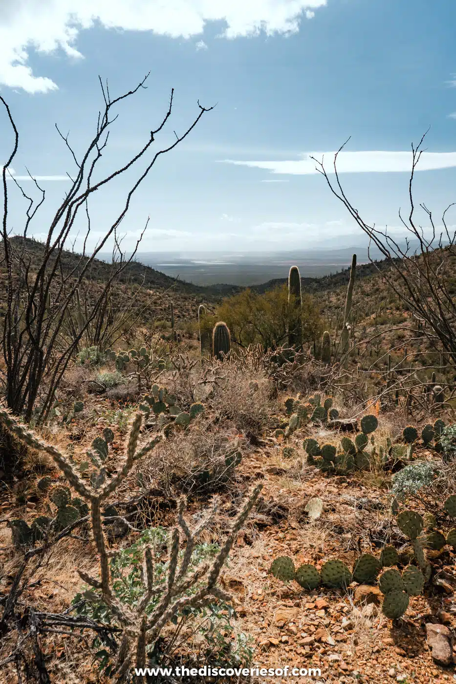
Imagine a cartoon cactus, arms raised to the sky. I’m pretty sure they’re all based on the ones you’ll find at Saguaro National Park. The park protects nearly 100,000 acres of Sonoran Desert in two districts, with the city of Tucson in between: Saguaro West (the Tucson Mountain District) and Saguaro East (the Rincon Mountain District).
If you only have time for one, go West, which has the most saguaros and is easier to explore thanks to its smaller size. Personally, I think it also had the most stunning scenery. For a hike, I highly recommend the King Canyon and Gould Mine loop: about 2.4 miles through a cacti-covered canyon and back on a pretty loop, with a picnic spot at the halfway point. It’s nice and easy, with some elevation gain, but not much. See my guide to the best Saguaro National Park hikes for more.
Entry is $25 per vehicle for seven days, and the America the Beautiful pass is accepted. Until 24 November 2026, Kinney Road is closed near the Arizona-Sonora Desert Museum for water line works, so follow the signed detour via McCain Loop to reach Saguaro West.
Top Tip
The only drinking water is at the visitor centres, so carry plenty with you. The desert heat can kill, literally. Visit from late April to early June to see the saguaros’ white blossoms, or see my guide to the best time to visit Saguaro National Park.
Meet desert wildlife at the Arizona-Sonora Desert Museum
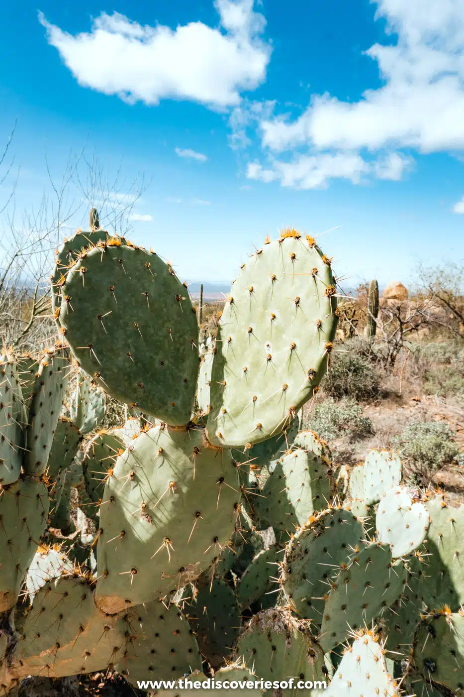
Just down the road from Saguaro West, the Arizona-Sonora Desert Museum is another must. It’s an outdoor museum charting the ecology of Arizona and the Sonoran Desert, with enclosures of native animals, like javelinas and coyotes, and gardens of native plants, including a colourful cactus garden.
It’s extensive, so plan to spend at least a couple of hours, and don’t miss the Desert Loop Trail. From mid-November to the end of March, you can also catch the Raptor Free Flight, when hawks and owls swoop just over the crowd. Entry is $29.95 for adults and $24.95 for children aged 3 to 12.
Admire Mission San Xavier del Bac
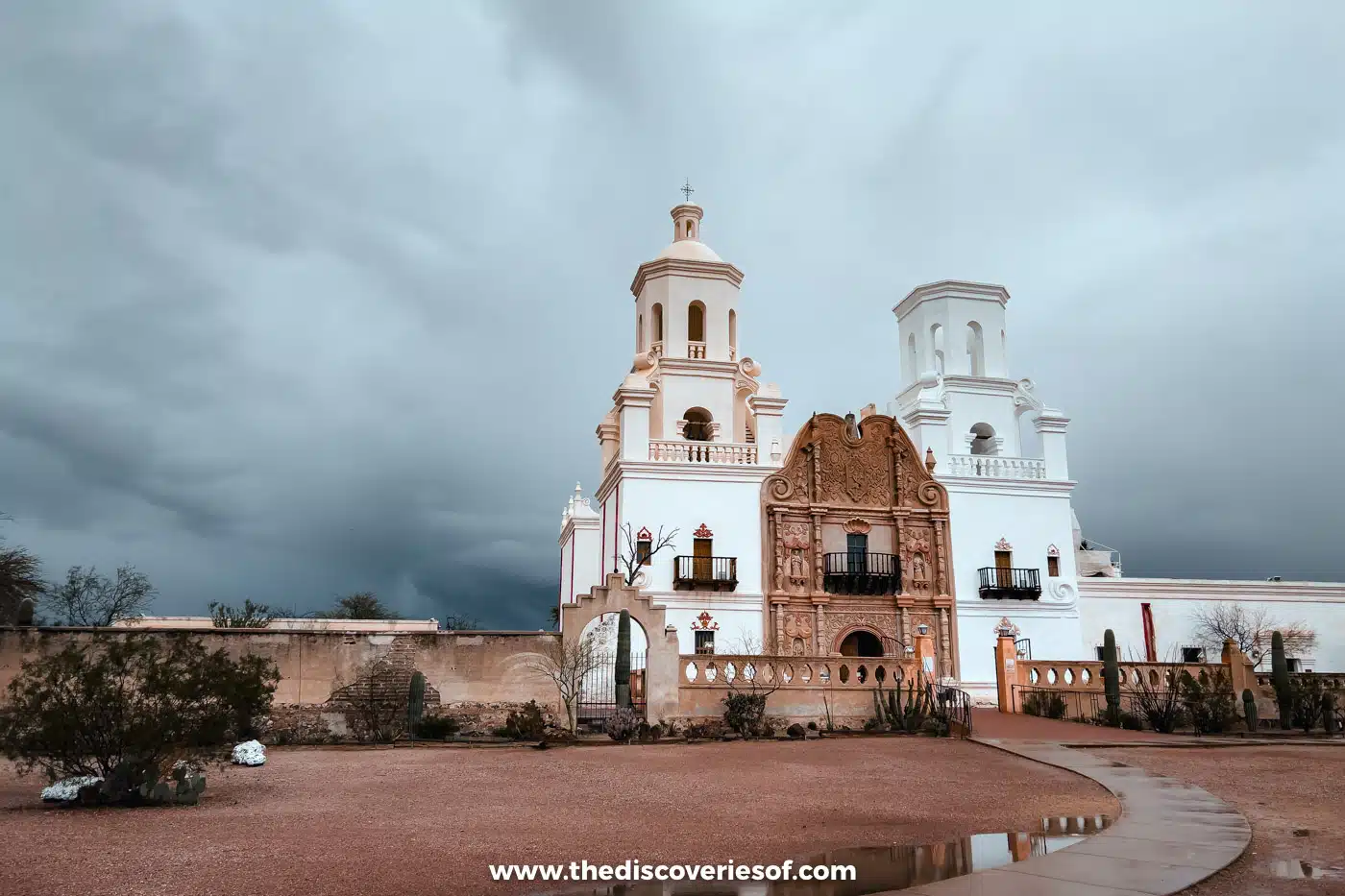
Known as the “White Dove of the Desert”, Mission San Xavier del Bac is a short drive out of Tucson and a must-visit. Spanish colonial architecture is relatively few and far between in southern Arizona, and this ornate example is stunning both outside and in.
The mission was founded in 1692 by the Jesuit missionary Eusebio Francisco Kino, and the present church was built between 1783 and 1797. It’s still an active parish church serving the Tohono O’odham community, about 9 miles south of downtown Tucson just off I-19, and entry is free.
Eat your way around Tucson
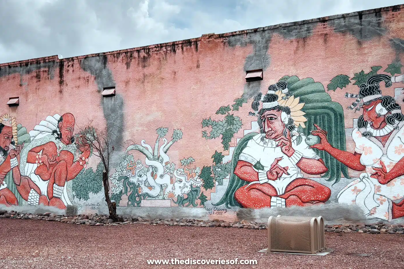
Tucson is far more than the desert city that sits between the two halves of Saguaro National Park. In 2015, it became the first city in the US to be named a UNESCO City of Gastronomy, thanks to more than 4,000 years of farming history and a Sonoran food culture all of its own.
I wandered the colourful adobe streets of Barrio Viejo, the city’s oldest neighbourhood, and stopped at El Tiradito, a little wishing shrine, and St Augustine Cathedral. I ate insanely good (and hearty) breakfasts at Cup Cafe in Hotel Congress and contemporary Southwestern cooking at Tito & Pep, one of my top five things to do in Tucson. Plan to spend at least two nights here, and if you have time, drive the Catalina Highway, which climbs from the desert floor to the cool pine forests near the summit of Mount Lemmon, at just over 9,000 feet.
Do
Learn the stories behind the adobe houses on this guided walking tour of Barrio Viejo, then see my guide to where to stay in Tucson.
Get out on Lake Powell
Page sits on a mesa above Lake Powell, a vast reservoir that snakes for miles through the red rock canyons of the Glen Canyon National Recreation Area on the border with Utah. It was created by Glen Canyon Dam, completed in the 1960s, and its turquoise water against the orange sandstone is quite a sight.
You can swim and paddle at Lone Rock Beach and Antelope Point, hire a kayak or a boat, or take a boat tour into the side canyons. Water levels have dropped significantly in recent years, which has closed some boat ramps and changed which tours can run, so check what’s operating before you go. Entry to the recreation area costs $30 per vehicle for a week, and America the Beautiful passes are accepted. See my guide to things to do in Page, Arizona for more.
Walk among ancient logs in Petrified Forest National Park

In north-east Arizona, about 26 miles east of Holbrook on I-40, Petrified Forest National Park protects one of the largest concentrations of petrified wood in the world. Around 225 million years ago, fallen trees here were buried in sediment and slowly turned to colourful quartz, and today their fossilised logs lie scattered across the desert.
The park covers about 346 square miles, and a 28-mile road runs through it, from the Painted Desert in the north to the Rainbow Forest in the south. Stop at the Tepees and Blue Mesa for their banded badlands, and at the historic Painted Desert Inn, now a museum. It’s also the only national park with a stretch of old Route 66 running through it, so it makes a great stop on a road trip along the Mother Road. Entry is $25 per vehicle for seven days (cards only).
Top Tip
For history lovers, Puerco Pueblo, an Ancestral Puebloan village last lived in around 1380, and the hundreds of petroglyphs (rock carvings) at Newspaper Rock are both short stops off the main road.
Explore the Vermilion Cliffs and The Wave
If you’re searching for a landscape that seems to move in waves before you, head to Vermilion Cliffs National Monument. Covering 293,689 acres of raw western terrain on the border with Utah, west of Page, it’s one of the most surreal places in Arizona, and a swift reminder that the desert is anything but samey.
Its most famous sight is The Wave, a swirl of striped sandstone in Coyote Buttes North. To protect it, only a small number of hikers are allowed in each day, and you’ll need a permit from the Bureau of Land Management, won either in an advance lottery on Recreation.gov about four months ahead or in a daily lottery that you enter on your phone when you’re in the area. Further south, Lees Ferry and the Navajo Bridge over Marble Canyon are good places to spot California condors, which were reintroduced to the region in 1996.
Do
For a taste of the area without a permit, this full-day White Pocket hiking tour from Kanab takes you deep into the Paria Plateau by 4×4.
Hunt for ghosts in Jerome

History buff? Arizona has plenty of old mining towns, but none are as atmospheric as Jerome. Clinging to the side of Cleopatra Hill high above the Verde Valley, it was once a booming copper town of around 15,000 people. When the mines closed in the 1950s, it almost emptied, earning it the title of the largest ghost town in America.
Today, around 450 people live here, and the old buildings are filled with art galleries, wine tasting rooms, cafés and quirky shops. Learn about the town’s mining history in the Douglas Mansion at Jerome State Historic Park, and look out for the stories of hauntings that the town is famous for. Just outside town, the Gold King Mine and Ghost Town is a quirky collection of old buildings and rusting mining machinery. Jerome is about 50 minutes’ drive from Sedona.
Do
This day trip from Sedona to Jerome and Tuzigoot National Monument includes the stories behind this once-illustrious little town.
Ski or ride the gondola at Arizona Snowbowl
Desert, what desert? If you’re visiting Arizona in winter, head to Arizona Snowbowl near Flagstaff, on the slopes of the San Francisco Peaks, for a day of skiing or snowboarding. It’s one of the best ski areas in the Southwest, and its 2026/27 season is due to open on 20 November.
Can’t make it in winter? In the warmer months, the Arizona Gondola carries you up to around 11,500 feet for huge views over northern Arizona, and fit hikers can take on Humphreys Peak, the highest point in the state at 12,633 feet. The Humphreys Trail climbs about 3,400 feet over 4.5 miles each way from the Snowbowl car park, so it’s a full-day hike, best tackled in summer or early autumn.
Stargaze under some of the darkest skies in the US
One of the perks of Arizona is its huge swathes of land protected from light pollution. In 2001, Flagstaff became the world’s first International Dark Sky City, and the Grand Canyon, the Flagstaff Area National Monuments (Sunset Crater, Wupatki and Walnut Canyon) and many of the state’s parks are certified International Dark Sky Places, with dry desert air and clear skies that make the Milky Way leap out on moonless nights.
At the Grand Canyon, Mather Point near the visitor centre is a lovely spot to watch the sunset and then stay on as the stars come out, and the park holds its Grand Canyon Star Party each June. Near Tucson, Kitt Peak National Observatory has reopened after works on its access road and runs evening stargazing programmes. See my guide to stargazing in the US for more of the best spots.
Do
Book the Kitt Peak Nightly Observing Program to look through research-grade telescopes on a mountaintop south-west of Tucson.
Discover Pluto’s home at Lowell Observatory

Lowell Observatory is one of the best things to see in Arizona if you want to learn about the universe, and who doesn’t? Founded by Percival Lowell in 1894 on Mars Hill above Flagstaff, it’s where Vesto Slipher’s measurements in 1912 gave some of the first evidence that the universe is expanding, and where Clyde Tombaugh discovered Pluto in 1930: both pretty big deals.
It has been a National Historic Landmark since 1965 and is still a working research observatory. General admission (about $35 for adults) includes the Astronomy Discovery Center, which opened in 2024 with interactive exhibits and a planetarium, and the Giovale Open Deck Observatory, where you can look through its telescopes on clear evenings. It’s open from noon to 10pm, but closed on Tuesdays.
Tickets
Book a Lowell Observatory general entry ticket ahead for evening visits in summer, when slots sell out.
Relive the Wild West in Tombstone
For a taste of the Wild West, head to Tombstone, about 70 miles south-east of Tucson. This silver-mining boomtown is best known as the scene of the Gunfight at the O.K. Corral in October 1881, when Wyatt Earp, his brothers and Doc Holliday faced off against the Clantons and McLaurys, and its wide dirt streets and wooden boardwalks still look the part.
The gunfight is re-enacted at the O.K. Corral every day, and you can visit the Bird Cage Theatre and the Boothill Graveyard. To dig into the real history, the red-brick Tombstone Courthouse State Historic Park, built in 1882, is now a museum on the town and Cochise County, with a recreated courtroom and sheriff’s office ($10 for adults). The old copper-mining town of Bisbee, with its colourful houses stacked up the hillsides, is about half an hour further south.
Do
Hear the town’s darker side on this hour-long Ghosts and Gunslingers walking tour after dark.
Drive a stretch of Route 66

It’s a cliché, but one of the must-do things in Arizona is a road trip along Route 66. Whether your reference point is Easy Rider or Lightning McQueen, the Mother Road is on many a bucket list, and it celebrates its 100th birthday on 11 November 2026.
The original road ran for 2,448 miles between Chicago and Santa Monica, and Arizona has some of its best-preserved sections. Sleep in a concrete teepee at the Wigwam Motel in Holbrook, stand on the corner in Winslow, and stop in Williams and Seligman, then drive the long, quiet stretch through Hackberry to Kingman and over the hairpins to Oatman, where wild burros wander the main street.
Explore Lava River Cave

Hidden in the Coconino National Forest about 14 miles north-west of Flagstaff, Lava River Cave is a lava tube about three-quarters of a mile long. How did it get here, I hear you ask? Around 700,000 years ago, molten rock flowed from a volcanic vent nearby; the outer layer cooled and hardened while the lava inside drained away, leaving the tunnel you can walk through today.
The walk through the cave and back takes one to two hours over an uneven, rocky floor, and it’s pitch black and between 35°F and 45°F (about 2°C to 7°C) inside all year round.
Top Tip
Bring warm layers, sturdy closed-toed shoes and at least two or three light sources. The forest roads to the cave are usually closed in winter because of snow and mud, adding a walk of about 4 miles each way, so visit from spring to autumn.
Hike to the turquoise pools of Havasu Falls
From a tribal homeland to majestic waterfalls, the Havasupai Reservation is a desert oasis hidden in a side canyon of the Grand Canyon. Here, the turquoise waters of Havasu Falls plunge about 100 feet into pools below, and the Havasupai people, the “people of the blue-green water”, have lived in the canyon for centuries.
Getting there takes planning. There’s no road in: it’s a 10-mile hike from Hualapai Hilltop to the campground, past the village of Supai, and day hikes aren’t allowed. Every visitor needs a permit bundled with a campground or lodge reservation from the Havasupai Tribe, with a minimum stay of three nights, booked through havasupaireservations.com. The season runs from February to November, and the tribe can close the canyon at any time, for example after flash floods.
Stand on the rim of Meteor Crater

Meteor Crater, also known as Barringer Crater, is one of the more unusual places to visit in Arizona. I mean, how often do you get to see a crater? About 37 miles east of Flagstaff, off I-40 at exit 233, the crater hides in the flat landscape until you step onto its edge and begin to understand its scale.
Around 50,000 years ago, an iron-nickel meteorite known as the Canyon Diablo meteorite slammed into the earth here, leaving a hole about three-quarters of a mile across and more than 550 feet deep. It’s one of the best-preserved impact craters on the planet, and the Apollo astronauts trained here. The crater is privately owned, so park passes aren’t valid: tickets cost $29 for adults online, including the visitor centre, its space museum and guided rim tours, and it’s open from 8am to 5pm.
See ancient cliff dwellings at Canyon de Chelly
In the north-east of the state, near the town of Chinle on the Navajo Nation, Canyon de Chelly National Monument protects sheer red sandstone canyons that have been home to people for thousands of years. Navajo families still live and farm on the canyon floor today, and the monument is run jointly by the National Park Service and the Navajo Nation.
Two scenic rim drives lead to ten overlooks, including the one for Spider Rock, a sandstone spire that soars about 750 feet from the canyon floor. The White House Trail takes you down to the White House Ruin, an Ancestral Puebloan cliff dwelling, and it’s the only trail you can walk on your own; to go anywhere else in the canyon, you’ll need a Navajo guide. There’s no entrance fee.
Discover volcanoes and pueblos around Flagstaff
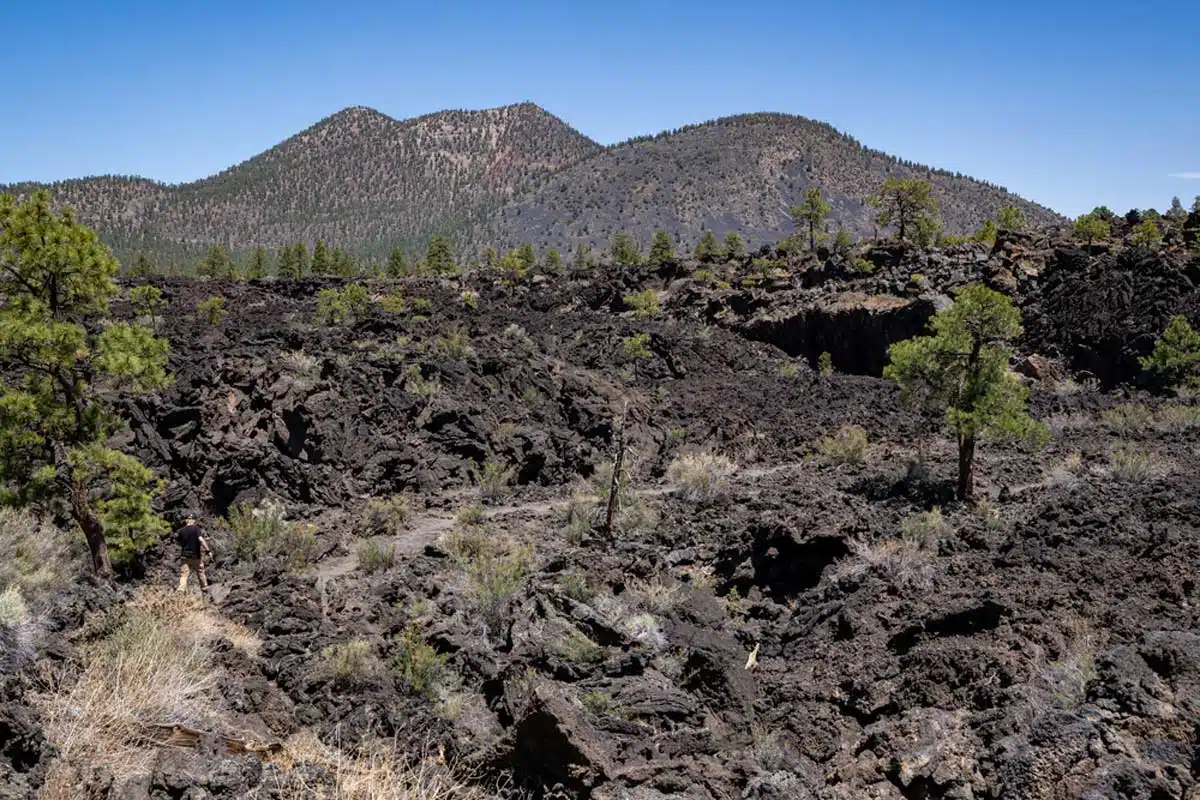
North of Flagstaff, the Sunset Crater-Wupatki Loop Road links two very different national monuments. Sunset Crater is the youngest volcano in the San Francisco volcanic field, a cinder cone that erupted around 1085 and still rises above fields of black lava. A little further on, Wupatki National Monument protects the red sandstone remains of pueblos built in the 1100s, including the 100-room Wupatki Pueblo, with a ball court and a natural blowhole. One $25 vehicle pass covers both.
East of town, off I-40, Walnut Canyon National Monument has cliff dwellings tucked under the limestone ledges of a forested canyon. See my guide to the best things to do in Flagstaff for more.
Go underground at Kartchner Caverns
In 1974, two young cavers discovered a hidden cave system in the Whetstone Mountains south-east of Tucson. They kept it secret for years to protect it, and today Kartchner Caverns State Park is one of the best-preserved “living” caves in the world, where the formations are still growing.
The cave can only be seen on a guided tour. The Rotunda/Throne Tour ($30 for adults) visits the 58-foot Kubla Khan column, while the Big Room Tour runs only from 15 October to 15 April, as the chamber is closed in summer, when a colony of bats moves in to raise their young. The park is about an hour’s drive from Tucson.
Peer inside Biosphere 2
At the foot of the Santa Catalina Mountains in Oracle, about 45 minutes north of Tucson, Biosphere 2 is one of the strangest sights in Arizona: a giant glass and steel complex built to recreate the earth’s ecosystems under one roof. Between 1991 and 1993, eight people were sealed inside it for two years in a famous experiment in self-sufficiency.
Today, it’s a research centre run by the University of Arizona, home to a rainforest, an ocean, a mangrove wetland and a desert. It’s open daily from 9am to 4pm (except Thanksgiving and Christmas), and a self-guided app tour of the habitats takes about an hour and a quarter.
Stand in four states at once at Four Corners Monument
On the Navajo Nation in the far north-east of Arizona, the Four Corners Monument marks the only place in the US where four states meet: Arizona, Utah, Colorado and New Mexico. It’s a quirky stop rather than a destination in itself, but it’s hard to resist the photo with a hand or foot in each state.
The monument is run by Navajo Parks and Recreation, with Navajo vendors selling crafts and fry bread around the plaza. From October to late March it’s open from 8am to 5pm (longer in summer), and it’s closed on major holidays. There’s a small per-person entry fee, and it’s about two hours’ drive east of Monument Valley.
Cross London Bridge in Lake Havasu City
Yes, really. In the far west of the state, on the shores of Lake Havasu, stands the 19th-century London Bridge that once spanned the River Thames. When the City of London put it up for sale in the 1960s, the American entrepreneur Robert McCulloch bought it for $2.46 million, had it taken apart stone by stone and rebuilt it here, and it reopened in 1971.
Today, the bridge links the town to an island in the lake, and the area around it is a popular spot for boating, swimming and watersports in the warmer months. Lake Havasu City is about three hours’ drive from Phoenix.
Marvel at Hoover Dam
On the Arizona-Nevada border, about an hour and a quarter from Kingman, Hoover Dam is one of the great engineering feats of the 20th century. Completed in 1936, the concrete arch-gravity dam rises 726 feet above the Colorado River in Black Canyon and holds back Lake Mead, the largest reservoir in the US by capacity.
Walk across the top of the dam, where the clocks on its two towers show the time in each state, and take a tour from the visitor centre on the Nevada side to see the power plant inside. For the best view of the dam itself, walk out onto the pedestrian path of the Mike O’Callaghan-Pat Tillman Memorial Bridge, which soars about 900 feet above the river.
Tips for visiting Arizona
- How long to spend: Arizona is the sixth-largest state in the US, so give yourself at least 7 to 10 days to see the highlights, and two to three weeks to explore at a slower pace. My Arizona road trip itinerary links the main sights in a logical route.
- When to go: spring (March to May) and autumn (September to November) are the best times to visit Arizona overall. Winter is perfect for Phoenix and Tucson, but it’s cold up north: the Grand Canyon’s South Rim is around 7,000 ft, and I saw Sedona in the snow in February. Summers are scorching in the low deserts, and the monsoon brings storms and flash floods from July to September.
- Park passes: the America the Beautiful pass costs $80 for US residents, and since January 2026 non-residents pay $250 for an annual pass or a $100 per-person surcharge on top of the entrance fee at 11 of the busiest parks, including the Grand Canyon. Navajo Nation sites, such as Monument Valley, Antelope Canyon and Horseshoe Bend, don’t accept federal passes.
- Watch the clock: most of Arizona doesn’t observe daylight saving time, but the Navajo Nation does, so from March to November it’s an hour ahead of the rest of the state. Check which time zone your Antelope Canyon or Monument Valley tour is booked in.
Where to stay in Arizona
Arizona is too big for one base, so split your stay between the Grand Canyon or Page in the north, Sedona or Phoenix in the middle and Tucson in the south.
In Sedona, I stayed at the Matterhorn Inn, a great-value hotel in the heart of Uptown that’s been revamped, with red rock views from every room. In Tucson, the Graduate by Hilton Tucson is a cool hotel at Main Gate Square by the University of Arizona, with relatively spacious rooms, mountain views, a rooftop pool and a rooftop bar. In Page, the Best Western View of Lake Powell is a good-value base on the rim of the mesa, about 10 minutes from Horseshoe Bend. For more options, see my guides to where to stay at the Grand Canyon, in Sedona and in Phoenix.
Map
Read next
- The ultimate Arizona road trip itinerary
- 10 days in the American Southwest: the perfect Southwest road trip itinerary
- The best things to do at the Grand Canyon
- 2 days at the Grand Canyon: the perfect Grand Canyon itinerary
- Stunning hikes in Grand Canyon National Park
- Where to stay in and near the Grand Canyon
- The best things to do in Sedona
- The best things to do in Tucson
- The best hikes in Sedona
- The ultimate USA travel bucket list
Love this? Save and share on Pinterest

Discover the top things to do, insider tips and hidden gems in our USA Travel Guides.
Read the guides →